SDL Portal Update: Town Maps
We are proud to launch a brand new and completely redesigned Town Map next week. The new map will be rolled out in phases and will serve as the core for all future development. When deployed, it will take the place of your existing portal map but will also be available to embed on your town website.
We are automatically upgrading the maps later next week but if you want to try them out now, you can navigate to the your town's portal map and append "?v=mb" to the url in the browser. Example: Cherry Hill Township & Franklin Township
Benefits:
- Single map for Web, Mobile, Desktop (later this year) and embedded in Town websites
- Easy to embed in your website or automatically added in SDL Sites
- Property and Building layers connected to all your municipal data
- New Search to include both tax properties and our new unit data for comprehensive town wide address management
- Fast, modern 2D/3D map display powered by Mapbox
- Includes easy links for Google Maps and Google Streetview
- Mobile friendly - fast maps and responsive layout
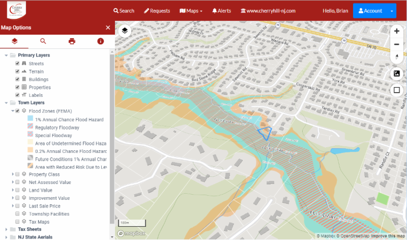
Map Layers:
- Base Maps - Streets, Satellite, Terrain, Properties, Buildings
- Town Maps (later this year) - Parks, Voting Districts, Wards, Recycling Routes, Complaints, Road Closings, Town POIs and anything in SDL Desktop that can be tied to a property. More information in a future release.
- Custom ArcGIS Online Maps - any map you can imagine!
- State/Federal Maps - NJ State aerials, DEP, FEMA, state layers are easily accessible and much faster than in previous versions
- Assessor Tax Map Sheets - if you have enabled Tax Sheets in Desktop, they will automatically be available in the map

Map Display
Fast 2D/3D display using Mapbox vector tiles. Smoothly pan and zoom around your town. Add and move layers using the new treeview control.

Document Display
Tax Map Sheets use our new Plan Viewer for incredibly fast access to your large scale documents. The Plan Viewer was developed for our forthcoming Online Plan Review and uses the same Mapbox technology as maps.
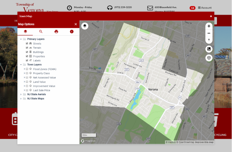
Easy Website Integration
The new map can easily be embedded on your town website. Get the embed code from your portal Town Admin page or contact SDL Support for help.
SDL Sites automatically includes a map page and also allows access from the account sidebar available on all pages.
SDL Sites also have a Town Status widget that use the new map layers to display relevant information to your citizens based on their location. (ex next recycling pickup based on map zone)

Sample Screens

.png?width=297&height=174&name=6%20(1).png)
 .
. .png?width=318&height=190&name=8%20(1).png)
 .
. 
 .
. 
SDL Mobile and Web
 .
. 
 .
. 
 .
. 